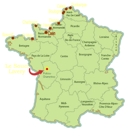
Location of Livery Deux-Sevres
We are situated in the mid-west of France, in the Deux-Sèvres region. (department 79). Ideally located just 20 minutes from the main autoroutes A83 and A10, we offer a good overnight stopping point, 6hours 15minutes from the port of Calais.
Exact location can be determined with GPS Coordinates:
Latitude: 46.47636435145557
Longitude: -0.33658504486083984
The table below shows driving times from the major ports to La Chapelle Bâton.
Click the Ferry port links
to show suggested routes by Via Michelin.
| Ferry Port | Driving Time |
| Boulogne |
6 hours 49 minutes. |
| Caen | 4 hours 24 minutes. |
| Calais | 7 hours 06 minutes. |
| Cherbourg | 5 hours 23 minutes. |
| Dieppe | 5 hours 37 minutes. |
| Dunkerque | 7 hours 09 minutes. |
| La Havre | 5 hours 12 minutes. |
| St-Malo | 3 hours 40 minutes. |
| Roscoff | 5 hours 08 minutes. |
Privacy Policy. Website Design and Hosting by Sarah Berry